
GroundIQ® demonstrates a 50% time-saving screening for pumping station
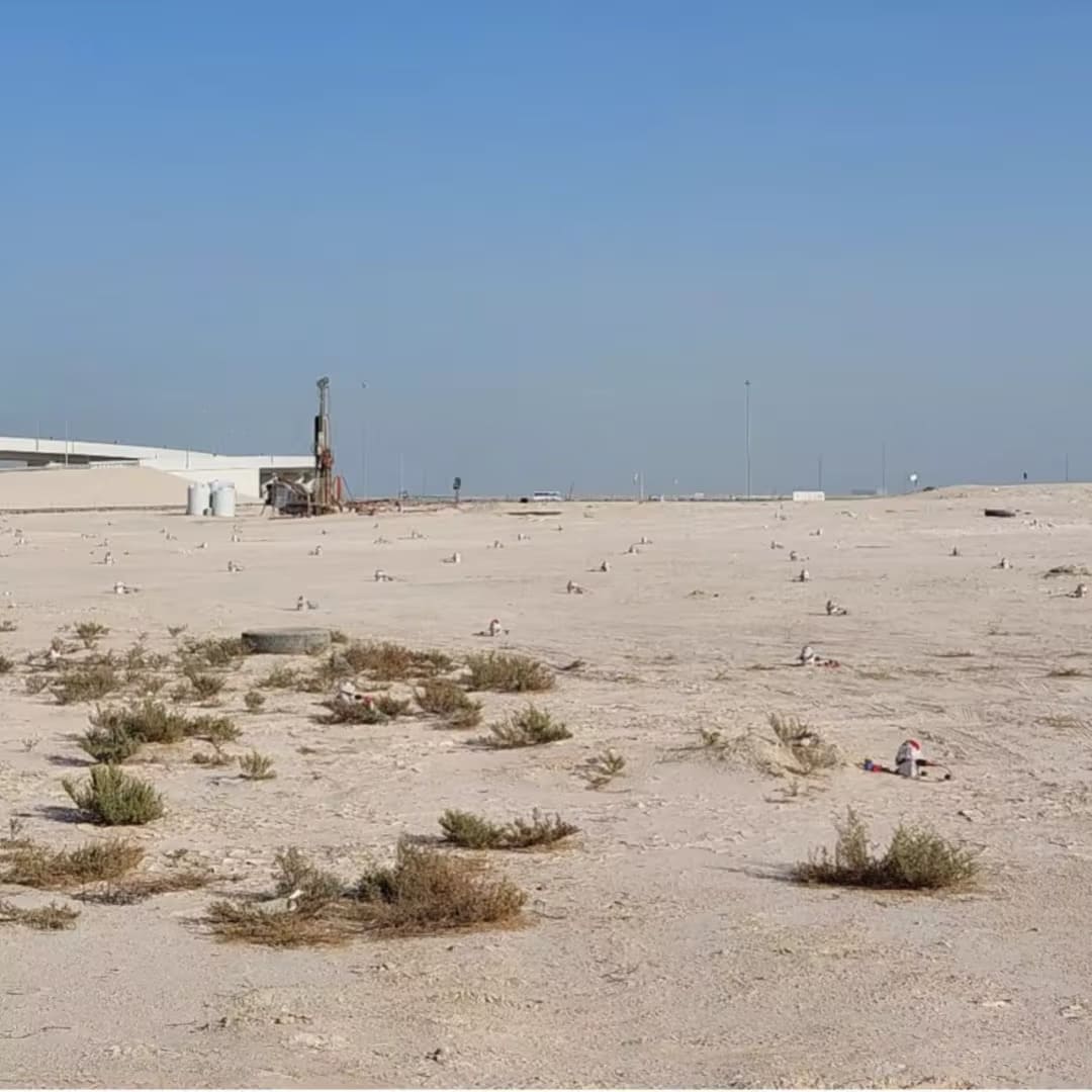
As part of Fugro's GroundIQ® solution, we used our patented 3D ambient noise tomography (ANT) technology to accelerate characterisation of the subsurface below a planned pumping station in Qatar to manage key design, construction and operational phase risks associated with the infrastructure development.


Stantec is a global engineering, architecture, and environmental consulting firm that delivers infrastructure projects across the water, energy, transportation, and buildings sectors. The company provides integrated planning, design, engineering, and project management services, helping clients develop resilient infrastructure in complex environments.


Impact at a glance
Project Overview
The planned stormwater pumping station formed a critical part of the area's future drainage infrastructure, making a reliable understanding of subsurface conditions essential from the earliest stages of design. At the time of the project, the engineering team needed greater confidence in the ground to help identify potential geohazards, reduce uncertainty, and support informed engineering decisions.
Time was of the essence and the client wanted to predict ground conditions and avoid unforeseen construction problems and gain early insights into the presence of any potential subsurface risks that could impact the construction and operation of the asset such as:
- Potential cavities – open or partially collapsed
- Zones of fractured or extremely weak rock, to a depth of 100 metres
Insights acquired from rapidly screening the subsurface, would help Stantec to reduce design uncertainty, support earlier and better decision-making and control project costs.

"For a critical infrastructure project, understanding potential geohazards is essential. The challenge was developing a reliable picture of subsurface conditions at depth without relying solely on point-based investigations."
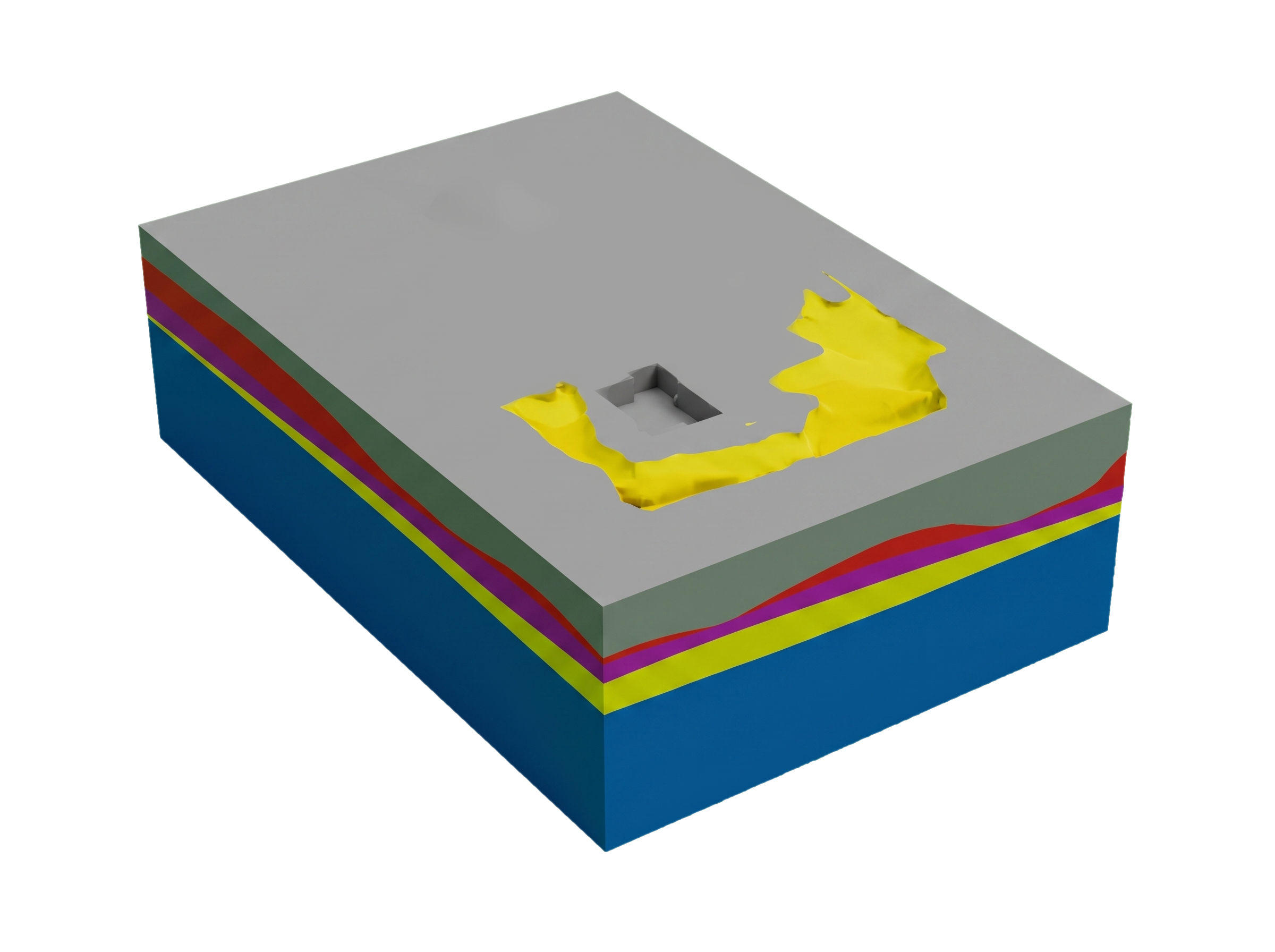
In conventional geotechnical investigations, the shear wave velocity (Vs) of the subsurface is related to the stiffness of the strata. Stiffness is a major design parameter in geotechnical engineering and a diagnostic parameter for geohazards. Our solution was to derive a 3D volume of shear wave velocity and subsequently stiffness through rapid geophysical screening with our ANT technology, part of GroundIQ®.
Our starting point for the geophysical investigation was to deploy about 400 small, wireless, autonomous and non-intrusive ANT sensors along three nested grids covering the site area: a grid with 6 m spacing directly on top of the target area (150 sq m); and coarser surrounding grids of 12 m and 24 m to capture long wavelength (deeper penetrating) information. The ANT sensors captured ambient seismic noise across the site for six days.
Acquired ANT data were processed using interferometric methods to extract coherent signals from the recorded seismic noise and to generate correlation Green’s functions that provided the input for both phase and group velocity analysis. Our proprietary software combines tomography and inversion to construct a robust and dense 3D Vs model of the subsurface, enabling its stiffness properties to be determined. Our 3D passive seismic results were in alignment with measurements derived from borehole PS logging and multi-channel analysis of surface waves (MASW).
"By transforming ambient seismic noise into a 3D model of subsurface stiffness, we were able to characterise the ground at depth and provide valuable insight into potential geohazards."
By using ANT technology, we delivered:
- Quick and easy set-up with small field crew: minimal environmental and community impact when compared to a fully conventional approach – 75% reduction in people and vehicles
- Deeper investigation (>100 m) than conventional geophysics to meet specific project needs of a deep excavation
- A 3D ground model that significantly reduced uncertainty of ground conditions resulting in an acceptable level of residual risk
- Time saving of at least 50% compared to a fully conventional geotechnical approach
The GroundIQ® assessment provided the project team with a solid understanding of subsurface conditions when it mattered most to Stantec. The resulting 3D ground model established a stronger foundation for subsequent geotechnical investigation, engineering analysis, and risk-informed project delivery.