
How GroundIQ® delivered high-resolution underground water mapping in challenging urban setting
A high‑end residential compound in Cairo faced persistent underground water accumulation that traditional methods could not explain. Using GroundIQ®, our team uncovered the hidden source, mapped the full extent of the issue, and guided safe, minimal‑impact remediation.


Confidential


Impact at a glance
Project Overview
The asset owner of a large residential compound in Cairo faced a persistent and costly issue of unexplained underground water entering building basements. Previous contractors had attempted to locate the source using drilling, piezometers and traditional surveys, but none of these methods provided a clear answer. The problem continued to escalate, and uncertainty grew. Pinpointing the source was essential. Without understanding where the water originated, the asset owner risked ongoing damage to buildings, roads, landscaping and buried utilities.
More drilling would have increased disruption, raised safety concerns and potentially caused further harm to the compound’s infrastructure. At the same time, relying on assumptions, rather than accurate subsurface insights, could lead to ineffective repairs, higher long‑term costs and repeated flooding.
The complex site conditions made the challenge even harder. Narrow landscaped corridors, completed roads and closely spaced buildings limited access, making intrusive investigation both risky and impractical. Yet the owner needed a comprehensive, high‑confidence ground model to guide a safe and lasting remediation plan.

"Finding water is one challenge. Understanding where it comes from and how it moves through the subsurface is what ultimately determines the right engineering solution."

To overcome these limitations, we deployed our GroundIQ® ground‑modelling approach, which integrates early, non-intrusive ground screening with targeted validation to reduce uncertainty and guide engineering decisions.
Our team combined Electrical Resistivity Tomography (ERT) and Transient Electromagnetic (TDEM) surveying with existing borehole logs supplied by other contractors, providing a clear picture without intrusive works.
Working between buildings, along narrow landscaped corridors, and across completed pavements, our light‑footprint technology allowed us to:
• Map water ponds and accumulation zones down to 20–25 metres
• Build detailed 2D profiles and a full 3D subsurface model
• Identify the precise water source
• Recommend only two targeted dewatering wells instead of dozens of boreholes
This integrated model clearly showed that the leakage originated from the irrigation drainage system, not natural groundwater, enabling immediate corrective action.
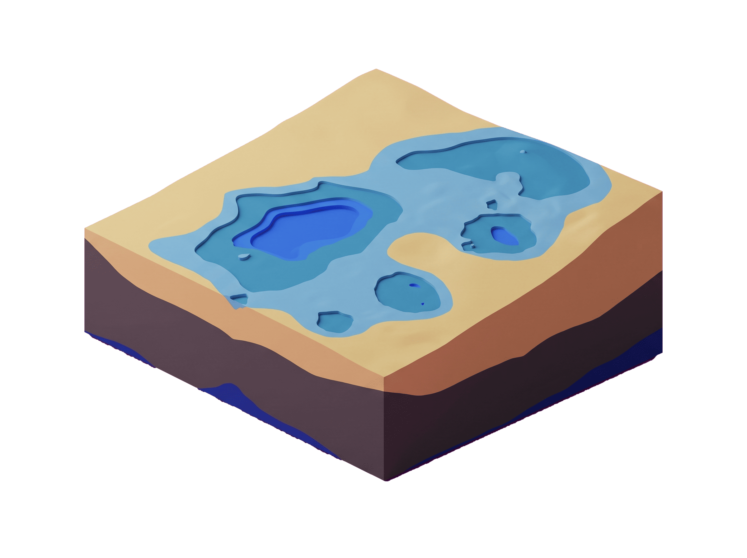
"By combining non-intrusive geophysical surveys with existing borehole data, we developed a validated ground model that pinpointed the source of the leakage and guided a targeted remediation strategy."
The client finally gained the clarity they had been unable to achieve through years of traditional investigations. Our work enabled them to:
• Fix errors in the irrigation design and drainage materials
• Install monitoring systems to regulate water use
• Strategically place dewatering wells and reduce excavation risks
• Protect landscaping and underground utilities by avoiding unnecessary drilling
A follow‑up GroundIQ® survey, completed one year later, confirmed a significant reduction in water volumes, validating both the model and the remediation strategy.